Description
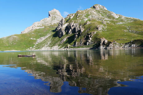
A must-do walk in Valloire! This intermediate-level trail will take you over the Lac du Grand Ban, through the Col and the Rochilles military camp. Admire these three natural high-altitude lakes and the breathtaking scenery!
Although this tour lasts an estimated 3 to 4 hours, we recommend you bring a picnic lunch so you can enjoy the lakes all day.
Technical point: there are some slippery stones on the 4x4 track.
Average physical difficulty due to its length and difference in altitude, the outward journey is all uphill.
To activate geolocation, click on the map icon.
Precautions:
- The routes you take are your own responsibility. You must choose a route adapted to your physical and technical capacity. If in doubt, do not hesitate to contact mountain professionals.
- Find out about the weather conditions before your departure.
- Be properly equipped to practice hiking in complete safety and deal with the vagaries of the weather.
Tell someone if you are leaving alone and prefer a morning departure so as not to be surprised by the night.
Departure - From the tourist office, head up Rue des Grandes Alpes towards the hamlet of Les Verneys 1 - Once you've crossed the bridge, walk along the parking lot to take the footbridge on the left of the main road to the "Vitta Vittel" fitness trail 2 - At the equestrian center, continue straight ahead to pass the Les Verneys chairlift 3 - Continue straight ahead on the path and then the D902 road along the river towards Col du Galibier and Plan Lachat. At Ferme des Etroits, take the route through the hamlet of Bonnenuit. 4 - At Plan Lachat, follow the 4X4 track up to Lac du Grand Ban, passing the military camp and Col des Rochilles. 5 - Follow the trail on your left to discover the next two lakes. 6 - Easy option: return along the same route. Difficult option: descent via the combe de l'Aiguille Noire (see black route no. 9).
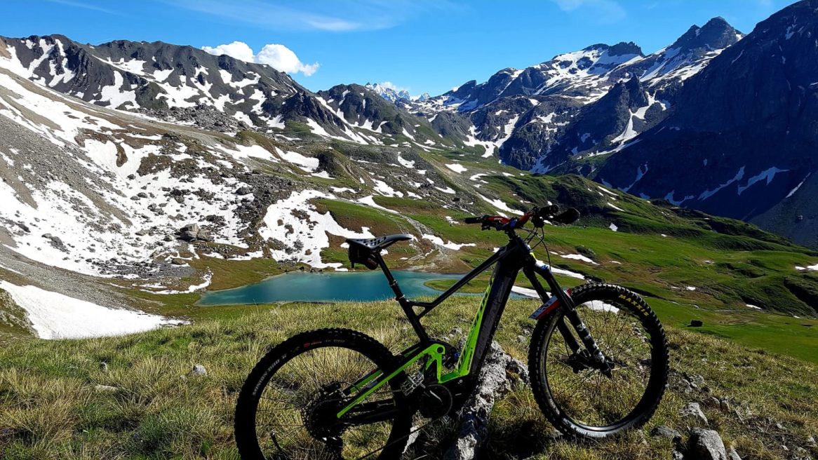
7 - Les 3 lacs - Mountain bike / ATV itinerary
-
Office de tourisme de Valloire
73450 Valloire - 04 79 59 03 96
- Site web
-
Opening
From 29/05 to 23/10.
Subject to favorable weather. - Contact
-
Prices
- Free access.