- Distance 10.1km
- Altitude maximum 2313m
- Altitude minimum n/c
- Marche 03h00
- Dénivelé positif 350m
- Dénivelé négatif 360m
- Commune de départ Valloire
- Nature du terrain Adapté aux poussettes tout terrain / Revêtement dur /
Description
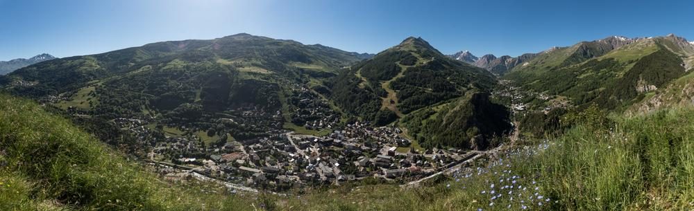
This walk is mostly on minor roads. The view from the chapel in the hamlet of Poingt Ravier is magnificent.
In winter, risk of avalanche in this area from level 3/5 this route is not recommended.
Guidebook with maps/step-by-stepStart - From the tourist office, take rue des écoles
1/ Cross the bridge and pass the campsite
2/ Walk past the tennis courts and cemetery towards the hamlet of Villard.
3/ Once in the center of Poingt Ravier, continue towards the chapel for a 360° view of Valloire.
4/ Return by the same route
When hiking, there are a few things you can do to make your experience safer and more enjoyable. Walking poles (even on roads) improve balance in icy conditions, crampons provide grip, and regular hydration is essential.
Carry a water bottle and snacks to keep your energy up. Protect yourself from the sun with sunscreen and sunglasses. Don't forget binoculars to add a touch of observation to your adventure.
Finally, check weather conditions and avalanche risks before you set off. Inform someone of your itinerary, as communication may be limited. These small adjustments will help you make the most of your getaway.
Poingt Ravier - Hiking itinerary
-
Office de tourisme de Valloire
73450 Valloire - 04 79 59 03 96
- Site web
-
Opening
All year round daily.
Subject to favorable weather. - Contact
-
Prices
- Free access.